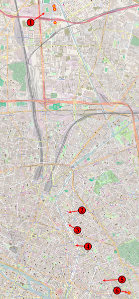
Plik:Parisattacks.png

Rozmiar podglądu – 279 × 598 pikseli. Inne rozdzielczości: 112 × 240 pikseli | 224 × 480 pikseli | 358 × 768 pikseli | 477 × 1024 pikseli | 1946 × 4171 pikseli.
Rozmiar pierwotny (1946 × 4171 pikseli, rozmiar pliku: 12,78 MB, typ MIME: image/png)
Historia pliku
Kliknij na datę/czas, aby zobaczyć, jak plik wyglądał w tym czasie.
| Data i czas | Miniatura | Wymiary | Użytkownik | Opis | |
|---|---|---|---|---|---|
| aktualny | 12:15, 20 lis 2015 |  | 1946 × 4171 (12,78 MB) | Veggies | Returning to original size. Map is unreadable in reduced version. |
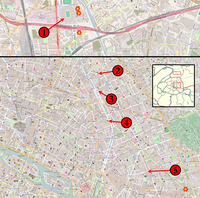
| 21:11, 19 lis 2015 |  | 933 × 2000 (3,85 MB) | Flappiefh | Reduced the size of the picture to relieve Wikimedia servers. | |
| 19:27, 18 lis 2015 |  | 1946 × 4171 (14,59 MB) | Flappiefh | Added a number next to the kamikaze attack near the Comptoir Voltaire. | |
| 05:18, 15 lis 2015 |  | 1946 × 4171 (12,79 MB) | Veggies | Added the locations for the individual suicide bombings around the stadium and at the Comptoir Voltaire restaurant on Boulevard Voltaire. | |
| 14:15, 14 lis 2015 |  | 1946 × 4171 (12,77 MB) | Veggies | Changed numbers to match order of attacks, added Casa Nostra location | |
| 06:17, 14 lis 2015 |  | 1946 × 4171 (12,78 MB) | Veggies | {{Information |Description ={{en|1=Map of the November 2015 Paris attacks in relation to each other.}} |Source =Base map from [https://www.openstreetmap.org OpenStreetMap] |Author =Veggies |Date =2014-11-14... |
Lokalne wykorzystanie pliku
Poniższa strona korzysta z tego pliku:
Globalne wykorzystanie pliku
Ten plik jest wykorzystywany także w innych projektach wiki:
- Wykorzystanie na ar.wiki.x.io
- Wykorzystanie na arz.wiki.x.io
- Wykorzystanie na as.wiki.x.io
- Wykorzystanie na az.wiki.x.io
- Wykorzystanie na bat-smg.wiki.x.io
- Wykorzystanie na bg.wiki.x.io
- Wykorzystanie na bn.wiki.x.io
- Wykorzystanie na br.wiki.x.io
- Wykorzystanie na bs.wiki.x.io
- Wykorzystanie na ca.wiki.x.io
- Wykorzystanie na ca.wikinews.org
- Wykorzystanie na cs.wiki.x.io
- Wykorzystanie na cs.wikinews.org
- Wykorzystanie na da.wiki.x.io
- Wykorzystanie na diq.wiki.x.io
- Wykorzystanie na el.wiki.x.io
- Wykorzystanie na en.wiki.x.io
- Wykorzystanie na eo.wiki.x.io
- Wykorzystanie na eo.wikinews.org
- Wykorzystanie na es.wiki.x.io
- Wykorzystanie na et.wiki.x.io
- Wykorzystanie na eu.wiki.x.io
- Wykorzystanie na fa.wiki.x.io
- Wykorzystanie na fi.wiki.x.io
- Wykorzystanie na fo.wiki.x.io
- Wykorzystanie na fr.wiki.x.io
- Wykorzystanie na fr.wikinews.org
- Wykorzystanie na ga.wiki.x.io
- Wykorzystanie na glk.wiki.x.io
- Wykorzystanie na gl.wiki.x.io
- Wykorzystanie na he.wiki.x.io
- Wykorzystanie na hi.wiki.x.io
- Wykorzystanie na hr.wiki.x.io
- Wykorzystanie na hu.wiki.x.io
- Wykorzystanie na hy.wiki.x.io
- Wykorzystanie na id.wiki.x.io
- Wykorzystanie na io.wiki.x.io
- Wykorzystanie na is.wiki.x.io
- Wykorzystanie na it.wikinews.org
- Wykorzystanie na ja.wiki.x.io
- Wykorzystanie na kk.wiki.x.io
- Wykorzystanie na ku.wiki.x.io
- Wykorzystanie na la.wiki.x.io
Pokaż listę globalnego wykorzystania tego pliku.


