Plik:Ordensland1410.png

Rozmiar podglądu – 568 × 600 pikseli. Inne rozdzielczości: 227 × 240 pikseli | 454 × 480 pikseli | 694 × 733 pikseli.
Rozmiar pierwotny (694 × 733 pikseli, rozmiar pliku: 130 KB, typ MIME: image/png)
Historia pliku
Kliknij na datę/czas, aby zobaczyć, jak plik wyglądał w tym czasie.
| Data i czas | Miniatura | Wymiary | Użytkownik | Opis | |
|---|---|---|---|---|---|
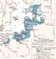
| aktualny | 00:47, 3 gru 2007 |  | 694 × 733 (130 KB) | Matthead | This map depicts "German rule of North and Baltic Sea in 14th and early 15th century during the height of the Teutonic Order (and the Hanseatic League)" *Ordensstaat possessions until 1410 marked in blue colors, with year of acquisition. *La |
Lokalne wykorzystanie pliku
Następujące strony korzystają z tego pliku:
Globalne wykorzystanie pliku
Ten plik jest wykorzystywany także w innych projektach wiki:
- Wykorzystanie na be-tarask.wiki.x.io
- Wykorzystanie na be.wiki.x.io
- Wykorzystanie na bg.wiki.x.io
- Wykorzystanie na ca.wiki.x.io
- Wykorzystanie na cs.wiki.x.io
- Wykorzystanie na da.wiki.x.io
- Wykorzystanie na de.wiki.x.io
- Pommerellen
- Neumark (Landschaft)
- Liste der Erzbischöfe von Riga
- Bistum Kurland
- Erzbistum Riga
- Deutschordensstaat
- Preußischer Bund
- Bistum Dorpat
- Litauerkriege des Deutschen Ordens
- Diskussion:Herzogtum Preußen
- Johannes von Wallenrode
- Bistum Reval
- Fürstbistum Ermland
- Jahrbuch Preußenland
- Ostseehandel
- Wikipedia:Auskunft/Archiv/2022/Woche 48
- Wykorzystanie na el.wiki.x.io
- Wykorzystanie na en.wiki.x.io
- Wykorzystanie na eo.wiki.x.io
- Wykorzystanie na et.wiki.x.io
- Wykorzystanie na eu.wiki.x.io
- Wykorzystanie na fa.wiki.x.io
- Wykorzystanie na fr.wiki.x.io
- Wykorzystanie na gl.wiki.x.io
- Wykorzystanie na he.wiki.x.io
Pokaż listę globalnego wykorzystania tego pliku.