Plik:Aster newyorkcity lrg.jpg

Rozmiar podglądu – 452 × 600 pikseli. Inne rozdzielczości: 181 × 240 pikseli | 361 × 480 pikseli | 578 × 768 pikseli | 771 × 1024 pikseli | 1964 × 2607 pikseli.
Rozmiar pierwotny (1964 × 2607 pikseli, rozmiar pliku: 3,31 MB, typ MIME: image/jpeg)
Historia pliku
Kliknij na datę/czas, aby zobaczyć, jak plik wyglądał w tym czasie.
| Data i czas | Miniatura | Wymiary | Użytkownik | Opis | |
|---|---|---|---|---|---|
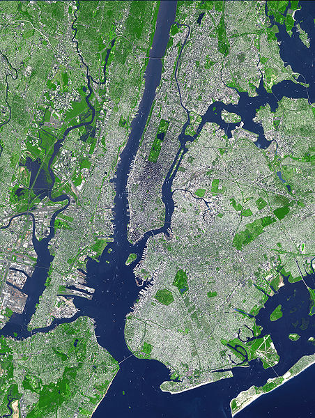
| aktualny | 19:54, 8 sie 2007 |  | 1964 × 2607 (3,31 MB) | HenrikRomby | {{Information |Description=This false-color satellite image shows Greater New York City. The Island of Manhattan juts southward from top center, bordered by the Hudson River to the west and the East River to the east (north is straight up in this scene.) |
Lokalne wykorzystanie pliku
Następujące strony korzystają z tego pliku:
Globalne wykorzystanie pliku
Ten plik jest wykorzystywany także w innych projektach wiki:
- Wykorzystanie na af.wiki.x.io
- Wykorzystanie na ar.wiki.x.io
- Wykorzystanie na ast.wiki.x.io
- Wykorzystanie na bn.wiki.x.io
- Wykorzystanie na ca.wiki.x.io
- Wykorzystanie na da.wiki.x.io
- Wykorzystanie na de.wiki.x.io
- Wykorzystanie na el.wiki.x.io
- Wykorzystanie na en.wiki.x.io
- Topography
- Hudson County, New Jersey
- User:TimAlderson/Userboxes
- Hudson Waterfront
- List of bridges, tunnels, and cuts in Hudson County, New Jersey
- User:NYCRuss/Sandbox/New York City
- Trees of New York City
- Talk:Trees of New York City
- Wikipedia:WikiProject New York City/Environment Task Force
- Wikipedia:WikiProject New York City/400 Task Force
- Wykorzystanie na en.wikibooks.org
- Wykorzystanie na eo.wiki.x.io
- Wykorzystanie na es.wiki.x.io
- Wykorzystanie na et.wiki.x.io
- Wykorzystanie na fi.wiki.x.io
- Wykorzystanie na fr.wiki.x.io
- Wykorzystanie na fr.wikinews.org
- Wykorzystanie na gl.wiki.x.io
- Wykorzystanie na he.wiki.x.io
- Wykorzystanie na hr.wiki.x.io
- Wykorzystanie na hu.wiki.x.io
- Wykorzystanie na hy.wiki.x.io
- Wykorzystanie na id.wiki.x.io
- Wykorzystanie na it.wiki.x.io
- Wykorzystanie na ja.wiki.x.io
Pokaż listę globalnego wykorzystania tego pliku.

