Plik:South East England districts 2011 map.svg

Wielkość pliku podglądu PNG dla pliku SVG: 749 × 600 pikseli Inne rozdzielczości: 300 × 240 pikseli | 600 × 480 pikseli | 959 × 768 pikseli | 1279 × 1024 pikseli | 2558 × 2048 pikseli | 1425 × 1141 pikseli.
Rozmiar pierwotny (Plik SVG, nominalnie 1425 × 1141 pikseli, rozmiar pliku: 2,18 MB)
Plik South East England districts 2011 map.svg znajduje się w Wikimedia Commons – repozytorium wolnych zasobów. Dane z jego strony opisu znajdują się poniżej.
Opis
| Opis |
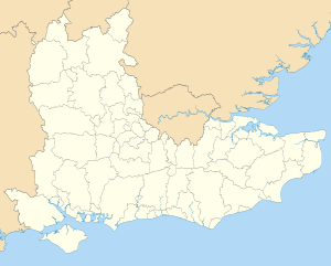
Map of the South East England region showing the administrative districts. Equirectangular map projection on WGS 84 datum, with N/S stretched 160% Geographic limits:
|
| Data | |
| Źródło |
|
| Autor | Nilfanion, created using Ordnance Survey data |
| Inne wersje |
Prace pochodne od tego pliku: |
Licencja
Ja, właściciel praw autorskich do tego dzieła, udostępniam je na poniższych licencjach
Ten plik udostępniony jest na licencji Creative Commons Uznanie autorstwa – Na tych samych warunkach 3.0.
- Wolno:
- dzielić się – kopiować, rozpowszechniać, odtwarzać i wykonywać utwór
- modyfikować – tworzyć utwory zależne
- Na następujących warunkach:
- uznanie autorstwa – musisz określić autorstwo utworu, podać link do licencji, a także wskazać czy utwór został zmieniony. Możesz to zrobić w każdy rozsądny sposób, o ile nie będzie to sugerować, że licencjodawca popiera Ciebie lub Twoje użycie utworu.
- na tych samych warunkach – Jeśli zmienia się lub przekształca niniejszy utwór, lub tworzy inny na jego podstawie, można rozpowszechniać powstały w ten sposób nowy utwór tylko na podstawie tej samej lub podobnej licencji.

|
Udziela się zgody na kopiowanie, rozpowszechnianie oraz modyfikowanie tego dokumentu zgodnie z warunkami GNU Licencji Wolnej Dokumentacji, w wersji 1.2 lub nowszej opublikowanej przez Free Software Foundation; bez niezmiennych sekcji, bez treści umieszczonych na frontowej lub tylnej stronie okładki. Kopia licencji załączona jest w sekcji zatytułowanej GNU Licencja Wolnej Dokumentacji. |
Możesz wybrać, którą licencję chcesz zastosować.
Historia pliku
Kliknij na datę/czas, aby zobaczyć, jak plik wyglądał w tym czasie.
| Data i czas | Miniatura | Wymiary | Użytkownik | Opis | |
|---|---|---|---|---|---|
| aktualny | 20:04, 1 maj 2011 | | 1425 × 1141 (2,18 MB) | Nilfanion | == Summary == {{Information |Description=Map of the South East England region showing the administrative districts. Equirectangular map projection on WGS 84 datum, with N/S stretched 160% Geographic limits: *West: 2.0W *East: 1. |
Lokalne wykorzystanie pliku
Żadna strona nie korzysta z tego pliku.
Globalne wykorzystanie pliku
Ten plik jest wykorzystywany także w innych projektach wiki:
- Wykorzystanie na ar.wiki.x.io
- Wykorzystanie na bs.wiki.x.io
- Wykorzystanie na ceb.wiki.x.io
- Wykorzystanie na en.wiki.x.io
- Hastings
- Isle of Wight
- Oxford
- Portsmouth
- Reading, Berkshire
- South East England
- Oxfordshire
- East Sussex
- Brighton and Hove
- Bracknell Forest
- Borough of Runnymede
- Crawley
- Reigate and Banstead
- Mid Sussex District
- Medway
- Hart District
- West Berkshire
- Borough of Waverley
- Royal Borough of Windsor and Maidenhead
- Adur District
- Arun District
- Gosport
- Sevenoaks
- Borough of Dartford
- Basingstoke and Deane
- Worthing
- City of Milton Keynes
- Cherwell (district)
- Wealden District
- Vale of White Horse
- Tonbridge and Malling
- East Hampshire
- Rushmoor
- Test Valley
- Gravesham
- Borough of Swale
- Folkestone and Hythe District
- South Oxfordshire
- West Oxfordshire
- Borough of Spelthorne
- Surrey Heath
- Borough of Elmbridge
- Mole Valley
- Epsom and Ewell
- Tandridge District
- Rother District
- Lewes District
Pokaż listę globalnego wykorzystania tego pliku.